Or enter page number and press GO:
Zoom
Rotate
High Resolution Image
Low Resolution Image
Citation
General report, Ireland, 1901
Page 82
| Maps and diagrams | (41 pages) | [Start|End] |
| Maps | (12 pages) | [Start|End] |
| Population | (Pages 81-82, Page 1) | [Start|End] |
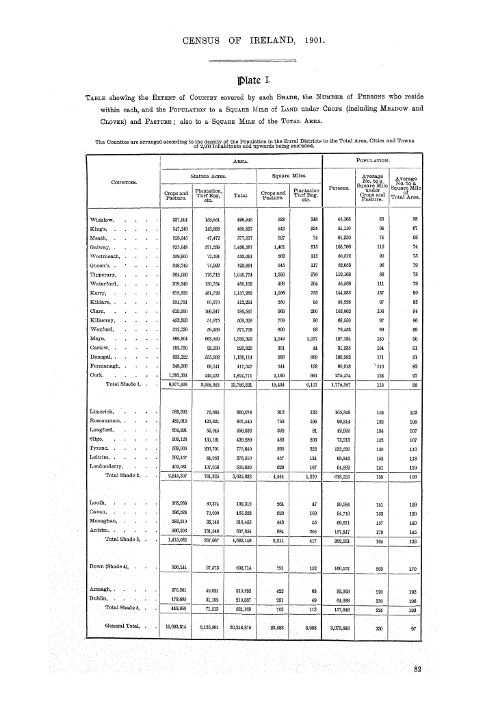
| Map table 1. Table showing the extent of country covered by each shade, the number of persons who reside within each, and the population to a square mile of laud under crops (including meadow and clover) and pasture; also to a square mile of the total area | (Page 82) | [Start|End] |

